
Prosper ZIP Code Directory Coverage
Three ZIP or ZCTA associations appear in the Prosper research record: 75078, 75009, and 76227. They are useful geographic leads, not three separate town districts. Prosper crosses Collin and Denton counties, and postal delivery, appraisal jurisdiction, municipal limits, school districts, and parcel lines do not all follow the same edge. Begin with the address as printed, then verify the delivery ZIP and the parcel's county before choosing a clerk or appraisal district.
| ZIP or ZCTA | Prosper association | Postal point | Research caution |
|---|---|---|---|
| 75078 | Core Prosper postal area | Prosper Post Office | Its postal boundary does not prove the town limit. |
| 75009 | Prosper and Celina-area addresses, plus northern Collin communities | Confirm the exact delivery result with USPS | County ZIP mapping associates Celina with 75009, while Census geography also associates part of the Prosper profile with it. |
| 76227 | Northern or outer Prosper association in the Census profile | Confirm the exact delivery result with USPS | A ZCTA association does not establish a Prosper post office or municipal address. |
There is no official Prosper table that assigns current population or registered-voter totals to these ZIPs within town limits. Census ZCTAs can supply statistical context, but they do not determine a parcel's delivery ZIP. Keep the five-digit ZIP, the exact USPS result, and the situs ZIP on a parcel card as separate facts.
Prosper ZIP Codes in Context
Prosper's official road atlas uses an A01:D16 grid and street-name index. It can place a street segment or subdivision on a map sheet, but its mapped positions are approximate. The Town's Data and GIS hub and interactive layers are better for comparing an address with annexation, road, zoning, and boundary information. County GIS supplies the parcel geometry that a ZIP cannot show.
This geography matters most near the town edges. Town forms identify Artesia with Denton County Sheriff association and territory north of Frontier Parkway with Celina Police Department association. Those clues illustrate a basic rule: a Prosper mailing line is not proof of the county, tax office, court, police jurisdiction, or deed custodian. The parcel ID and legal description carry farther than the postal city.
Note: The Town's updated platting process took effect July 1, 2026, so new subdivision and legal-description details should be checked in current Town and county records.
75078 and Prosper Post Office
The USPS Prosper Post Office record identifies the core 75078 office at 941 N Coleman Street. Retail hours are Monday through Friday, 8:30 a.m. to 5 p.m.; the listed telephone number is 972-347-2543. USPS announced a relocation on June 14, 2021 and said the ZIP and post-office-box number remained the same. That continuity applies to the office's postal identifier, not to every address that may use Prosper in a mailing line.
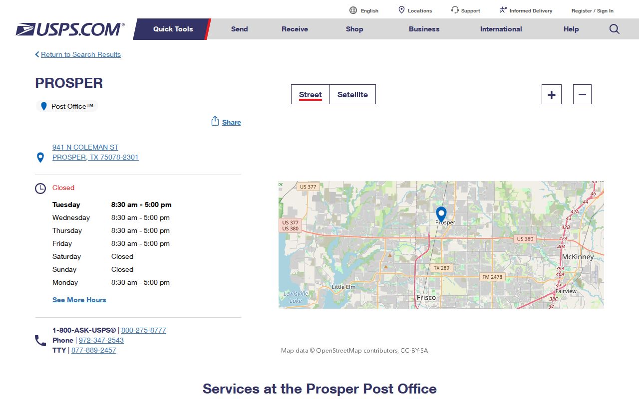
Use USPS as the final check for a delivery address. The Collin County ZIP map, dated March 22, 2022, is useful context, but it should not override an exact USPS address result or a parcel record.
ZIP Filters for Prosper Records
ZIP filters are not uniform across local record systems. The Texas HOA management-certificate search explicitly accepts HOA name, county, city, ZIP, and association type. It is a useful way to identify an association or management contact for a subdivision, but its results do not identify residents or list association members. In contrast, the public appraisal and voter lookup tools do not offer a documented ZIP-only resident search.
| Search field | Format | What the result is for |
|---|---|---|
| HOA name | Text | Locate a known association certificate. |
| County | Filter | Separate Collin and Denton associations. |
| City | Filter | Refine an association search to Prosper. |
| ZIP | Filter | Find association records tied to a postal area. |
| Association type | Filter | Narrow the state certificate results. |
The Collin Central Appraisal District search instead exposes owner, street, property ID, geographic ID, subdivision, neighborhood, tax year, and legal-description routes. No explicit ZIP-only field was documented. Denton CAD stores situs and mailing ZIP data, but its inspected public instructions emphasize property ID, address, owner, subdivision, city, school district, and year rather than a ZIP-wide result.
The Collin CAD property-search screen shows the address and owner controls used after the postal check.

Its parcel result is appraisal research, not the recorded deed. Compare the legal description with the county-clerk instrument before treating an ownership entry as confirmed.
Finding Prosper Records by ZIP Code
A ZIP can narrow an address question without becoming a ZIP-wide resident search. The useful route starts with a single exact address and ends with the county record that controls the fact being checked. It avoids assuming that every parcel inside a postal area belongs to the same town or county.
- Check the exact address through USPS and record the five-digit ZIP separately from any ZIP+4 suffix.
- Use Prosper or county GIS to identify the parcel, town boundary, and whether the address belongs on the Collin or Denton side.
- Search CCAD or Denton CAD by the known address, owner, property ID, or legal description, rather than expecting a ZIP-only result.
- Use the matching county clerk's land index to compare the deed's lot, block, subdivision, abstract, or tract with the parcel card.
Once a ZIP has narrowed the area to a named street, the Prosper street directory has the fuller address-by-address record trail. The Collin public voter form requires first name, last name, and date of birth; it does not provide a public ZIP filter. A full voter-file request has separate fee and statutory-use rules, and Denton-side voters belong with the Denton registrar.
Prosper ZIP Code Parcel Checks
A postal result should be paired with a property record before it is used to choose a county office. On a Collin parcel, the appraisal card may show a property ID, geographic ID, owner name, owner percentage, mailing lines, subdivision or abstract, block, tract or lot, legal description, situs street and ZIP, tax entities, property type, value fields, exemptions, and a map or sketch link. Denton parcels need the same county-specific appraisal check. These are useful identifiers, but an appraisal result is not the final proof of a current household or recorded title.
Three address labels may appear in the same search. The mailing address is where appraisal or tax correspondence goes. The situs address is where the improvement sits. The legal description identifies the land through a subdivision, lot and block, abstract and tract, or other land description. The legal description is the durable bridge when a postal city changes, a street name is absent from an older deed index, or a town boundary is unclear. Copy it exactly before moving from CAD to the clerk.
For a Collin result, search the owner as grantee in the official-records index and compare the likely deed's legal description, recorded date, document type, and party roles. Then use the prior grantor as a new grantee search when a historical title question requires it. A Denton-side parcel follows Denton CAD and the Denton County Clerk instead. The two-county split is why a known ZIP or postal city cannot select a deed index on its own.
Parcel fields can also prevent a false match. When a surname returns several properties, compare the geographic ID, subdivision, legal description, and mailing city. If the owner is an entity, trust, or estate, use the recorded document and relevant authorized-party or probate record rather than guessing a natural person. The resulting trail is specific enough to check again later.
A Prosper tax account is a separate layer from the appraisal card. It can show an account, property location, owner or address, and payment or delinquency status, while CAD handles valuation and the clerk holds the title record. A delinquent-tax or foreclosure notice is a legal-process lead, not proof that a foreclosure was completed. Check the court file, sale notice, and later deed before drawing that conclusion.
Prosper ZIP Code Terms
Postal and parcel labels answer different questions. Keeping their terms separate makes it easier to search old and new records without treating a mailing detail as land-title evidence.
- ZIP code
- A postal delivery area used to route mail. It is not a town-boundary or county-boundary record.
- ZIP+4
- A five-digit ZIP plus a delivery-point suffix. The 75078-2301 suffix should not be copied into older records that predate it.
- ZCTA
- A Census statistical area built around ZIP geography. It can overlap an incorporated town without matching each delivery address.
- Situs address
- The parcel's physical location on an appraisal record, distinct from an owner's mailing address.
Older newspapers, directories, and census material may use a rural route, box number, post-office name, Rock Hill, Richland, or another historic community label. Search the printed place and county first, then connect it to a modern parcel only after map, plat, and deed details agree.
Prosper ZIP Code Boundary Limits
The Census Prosper profile associates 75009, 75078, and 76227 with the incorporated town, but that association is ZCTA context, not a list of addresses inside town limits. A postal boundary, a municipal boundary, and parcel geometry are three different shapes. GIS may display all three, and each has a different purpose.
For an uncertain edge address, use the exact USPS result for delivery, Town or county GIS for the boundary and parcel, the appraisal district for property identifiers, and the correct county clerk for title. This sequence is also safer for public-information requests: send a narrow, dated request to the office that holds the record rather than relying on a postal label alone.